Above: End of Lachine rapids is circled. Colored code map is from canoeing association Fédération Québécoise de Canot-Camping
Here is 3 pictures that will give someone an idea of the drop that represents the Lachine rapids and the following current which links St-Louis lake (a St-Lawrence river enlargement) to downtown Montreal. The drop can be appreciated in terms of story levels of downtown Montreal highest buildings.
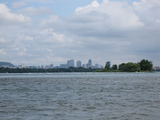
Above: view of downtown Montreal from Lac St-Louis. Only the top section of the highest buildings can be observed. The drop from St-Louis lake to downtown Montreal ground level is therefore probably around 20 to 30 story high.
Above: View of downtown Montreal from the bottom of the Lachine rapids. Still a fare number of story levels to go down before reaching downtown ground level.
Above: Downtown Montreal ground level. These last 3 pictures gives a hint of the 3D nature of Montreal island. It would be awesome to have a complete 3D picture of Montreal island one day.
For old bridge fans, Victoria bridge can be observed here. At one point this bridge I think was the longest in the world (around 1875 I would say). Designed originally for trains, it now allows car as well and cargo can pass thanks to elevation of a section of the bridge without traffic interruption.
For old bridge fans, Victoria bridge can be observed here. At one point this bridge I think was the longest in the world (around 1875 I would say). Designed originally for trains, it now allows car as well and cargo can pass thanks to elevation of a section of the bridge without traffic interruption.
From Lasalle waterfront I went across toward the end of Heron island. Heron island cuts the Lachine rapids in two. The end of the island coincide more or less with the end of the rapids. Here are some pictures.
Above: View of Mont-Royal from the end of Heron island.
Above: Heron island is cut in two actually. The right section is actually named Ile aux Chèvres (goat island) and the left section is the actual Heron island. But no one knows that (I learned this from Googlemap).
Above: Heron island is cut in two actually. The right section is actually named Ile aux Chèvres (goat island) and the left section is the actual Heron island. But no one knows that (I learned this from Googlemap).
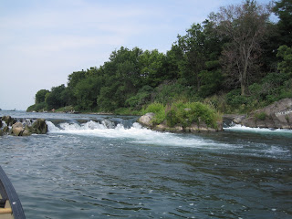
Above: Nice drop beside Rock island. Rock island is a tiny island someone can encounter just before crossing toward the end of Heron island. There is actually a little quay and a picnic table on this side of the island.
Above: view of some Heron island country houses from Rock island.
Above: upstream view of the Lachine rapids from Rock island. The real crazy action is where the tiny white line is far up. It must be unreal there with types of current unseen before. I consider the current around Rock island 5 to 10 times less violent then what is up there (observed with binocular of course when I was near that section on the waterfront one day) but still I have observed some pretty strange water current patterns around Rock island.
Now here are some picture of the Lachine rapids viewed from the other side of Heron island (the south side).
Above: A nice drop can also be observed a bit upstream from the end of Heron island.
Above: A violent rapid section is present near the south shore waterfront (tiny white lane further away).
Above: As for the north side of the Lachine rapids, the real action is much more upstream (white lane way upstream). I don't think I will ever try that section. The currents must be way to unpredictable and with currents that traps you.
Above: Small scale version of a bizarre current that the Lachine rapids I am sure can offer all over the place. Here I needed to paddle pretty hard after taking this picture to get out backward of the deceptively not that small counter current that can be observed closest to the camera.


Your photos 10 to 13 are what we Heron Islanders call the Second Falls .photo 13 is the part closest to the shoreline and we call that part the Chute.In photo 10 I can see the word unting ,well it said No Hunting when I painted it there back in 1970 at the age of 15.I still have a place there now just upriver from that falls.I enjoyed your photos.
ReplyDeleteHi! Can we go to the island or is it all private?
ReplyDeletePrivate
Delete