Above: Du Nord river section described in this blog. Color coded map is from canoeing association Fédération Québécoise du Canot-Camping
Above: Turn right at this sign on St-Canut boulevard for canoe landing.
Above: canoe landing spot. Upstream is on the right.
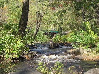
Above: Soon going upstream you will find that nice little R1. Little waves perfect to familiarize with canoe surfing. Passing the rapid with feet in the water over the rocks easy from the left side.
Above: Little island just upstream the rapid. Easier to paddle upstream on the right side.
Above: Tangle of logs and branches behind the island gives an idea of spring water levels.
Above: River banks has still a few of traditional decent size country houses.
Above: This traditional style country house respects the river high waters.
Above: The bridge of St-Canut.
Above: Little stream ending in Du Nord river on the left side of St-Canut bridge.
Above: Another little stream ending in the river on the left side of St-Canut bridge.
Above: The river banks on this section of the river is in general very well preserved.
Above: Minks are making a comeback in urban areas where rivers banks are decently conserved.
Above: Anywhere on river sections with low slopes you will find musk rats and their huts.


No comments:
Post a Comment