Tuesday, 23 August 2011

Canoeing St-Louis lake from Pointe-Claire

St-Louis lake is a St-Lawrence river enlargement on the south west side of Montreal island (see also other St-Louis lake blog april 2011). Pointe-Claire (Clear-Point) is a Montreal borough a few km west of downtown Montreal. St-Louis lake sits just upstream of the mighty Lachine rapids (see other blogs). Pointe-Claire is where the fur traders named Voyageurs (the Travelers) were leaving for there annual trip around Huron lake from april to november in large canoes called rabaska. Canoe landing is possible from the park at the end of Cartier street in Pointe-Claire (free parking). The area around the park is canoe friendly with minimal motor boats. There is a lot of sail boats,  and I think there is even a sailing school not far. You are almost assured to see one or two sturgeons jumping out of the water every time you go there. Here are some pictures (no sturgeons included, sorry).


Above: Circled area where canoe spot is. Colored code map is from canoeing association Fédération Québécoise de Canot-Camping


Above: west side view from the park. I think this is the historical Pointe-Claire. Further away we see part of Perrot island.


Above: closer view of the historical Pointe-Claire.


Above: south side view from the park in Pointe-Claire. Across somewhere is the town of Chatauguay where the river of the same name ends (see Chatauguay river blog).


Above: the church of Pointe-Claire I guess. It sits on the west side of the park.


Above: East side view from the park. Mount-Royal in sight. Left is University of Montreal, center there is St-Joseph oratory and right the tip of downtown Montreal highest buildings can be observed or guessed (for the not convinced).

Sunday, 14 August 2011

Canoeing the Lachine rapids on the St-Lawrence river: section Lasalle part II

For introduction go to the july 2011 version 1 of this blog ''Canoeing the Lachine rapids on the St-Lawrence river: section Lasalle''. This time I parked near the river front across Douglas hospital on Lasalle Boulevard. There is a parking there free of charge.


Above: End of Lachine rapids is circled. Colored code map is from canoeing association Fédération Québécoise de Canot-Camping

Here is 3 pictures that will give someone an idea of the drop that represents the Lachine rapids and the following current which links St-Louis lake (a St-Lawrence river enlargement) to downtown Montreal.  The drop can be appreciated in terms of story levels of downtown Montreal highest buildings.


Above: view of downtown Montreal from Lac St-Louis. Only the top section of the highest buildings can be observed. The drop from St-Louis lake to downtown Montreal ground level is therefore probably around 20 to 30 story high.


Above: View of downtown Montreal from the bottom of the Lachine rapids. Still a fare number of story levels to go down before reaching downtown ground level.


Above: Downtown Montreal ground level.  These last 3 pictures gives a hint of the 3D nature of Montreal island. It would be awesome to have a complete 3D picture of Montreal island one day.
For old bridge fans, Victoria bridge can be observed here. At one point this bridge I think was the longest in the world (around 1875 I would say). Designed originally for trains, it now allows car as well and cargo can pass thanks to elevation of a section of the bridge without traffic interruption.

From Lasalle waterfront I went across toward the end of Heron island. Heron island cuts the Lachine rapids in two. The end of the island coincide more or less with the end of the rapids. Here are some pictures.


Above: View of Mont-Royal from the end of Heron island.


Above: Heron island is cut in two actually. The right section is actually named  Ile aux Chèvres (goat island) and the left section is the actual Heron island. But no one knows that (I learned this from Googlemap).


Above: Nice drop beside Rock island. Rock island is a tiny island someone can encounter just before crossing toward the end of Heron island. There is actually a little quay and a picnic table on this side of the island.


Above: view of some Heron island country houses from Rock island.


Above: upstream view of the Lachine rapids from Rock island. The real crazy action is where the tiny white line is far up. It must be unreal there with types of current unseen before. I consider the current around Rock island 5 to 10 times less violent then what is up there (observed with binocular of course when I was near that section on the waterfront one day) but still I have observed some pretty strange water current patterns around Rock island.

Now here are some picture of the Lachine rapids viewed from the other side of Heron island (the south side).


Above: A nice drop can also be observed a bit upstream from the end of Heron island.


Above: A violent rapid section is present near the south shore waterfront (tiny white lane further away).


Above: As for the north side of the Lachine rapids, the real action is much more upstream (white lane way upstream). I don't think I will ever try that section. The currents must be way to unpredictable and with currents that traps you.


Above: Small scale version of a bizarre current that the Lachine rapids I am sure can offer all over the place. Here I needed to paddle pretty hard after taking this picture to get out backward of the deceptively not that small counter current that can be observed closest to the camera.

Friday, 29 July 2011

Canoeing around the Charlevoix region in the province of Quebec

Charlevoix region is downstream Quebec city on the north side of the St-Lawrence river estuary. This region combines mountain geography to maritime geography. The St-Lawrence river estuary is huge (25 + km wide by maybe 400 km long) and therefore behaves much more like the open sea than has an estuary. Tidal cycles are spectacular. Mountains are very nice with little rivers and streams all over the place. Charlevoix region is also pound country. So many natural streams allow for easy pound landscaping. To go to Charlevoix region from Montreal take highway 20, cross the bridge at Quebec city on the 73 north. Take the highway 40 east toward Ste-Anne de Beaupré. Then the route 138 east toward Ste-Anne de Beaupré. It should take you around 3 hrs to get there. This flat section on the 138 toward Ste-Anne de Beaupré is called Cote de Beaupré and runs beside Orléan island. The St-Lawrence estuary starts after Orléan island with an abrupt widening. You can use the scenic route on your left instead of the 138 for that flat section if you like old houses (19th and 18th century) or else. Turn left at the l'Ange Gardien light on the 138 for the Route Royal or route 360 (the first route in North America). Here are pictures of two types of old building you can see on the Royal road that I never saw in Quebec before.


Above: tentative translation from French, a vegetable warehouse (19th century).  Several of these can be seen on route 360 near Chateau-Richer.


Above: tiny chapel seen on route 360 near Chateau-Richer.

Past the Cote de Beaupré area the route 138 suddenly attack the mountains of Charlevoix and follow   
their landscape. At several point on the 138 you can get access to the St-Lawrence estuary by following the roads that goes perpendicular to the 138 and that leads to small villages that sits on the estuary. Here are some pictures of the road that leads to Petite-Rivière St-Francois (maybe 60 km downstream Quebec city).


Above: Canoeing landing spot is circled. Colored code map is from canoeing association Fédération Québecoise de Canot-Camping.


Above: the roads that allow access to the St-Lawrence estuary from the route 138 are typically a bit rough on the brakes. Keep your speed low and use the drive 2 on your transmission when needed.


Above: emergency exit if brakes goes off. Of course no one wants to see how it goes for real if the brakes take a brake.


Above: the St-Lawrence estuary in sight.


Above: the Petite Rivière St-Francois municipal quay. Cargos are common on the estuary. To get access to the quay turn left after the village church. You can park on the quay. Went canoeing from the quay. Locals are not familiar with people canoeing on the estuary. They will typically inquire to see what level of awareness someone has about the estuary (tidal cycle, sudden change in wind direction etc). So to keep them without worry I said ''I will canoe near the coast and I will go counter-tide''.


Above: view of Petit Rivière St-Francois church during daytime.


Above: view of the church during sunset.


Above: high tide upstream of the quay.


Above: high tide downstream of the quay.


Above: low tide upstream of the quay.


Above: low tide downstream of the quay


Above: all the big rocks seen at low tide here and almost everywhere on the banks are gone at high tide.


Above: canoeing downstream the estuary should bring someone in theory into the real open sea.

Here are some pictures of two prototypical small Charlevoix rivers.


Above: covered bridge at St-Placide de Charlevoix on the Bras du Nord-Ouest river. Parking possible beside the bridge. To access the bridge, follow the covered bridge sign on route 138 at around 1 km west of the road that leads to Petite Rivière St-Francois. Trout fishing possible with a provincial fishing permit.


Above: Rivière du Sot. It crosses the road that leads to Petite Rivière St-Francois when the road gets flat.  
Walking on the rocks fairly easy. Of course its much more efficient to walk around in those types of rivers by getting your feet wet with a good pair of sports shoes and hiking sticks. To get access to the river by feet, walk into the woods on the left side of the bridge than down to the river when the steepness of the bank gets less severe.


Above: river landscaping done on the Rivière du Sot by I dont know who. Titans maybe. This can be observed maybe after a 45 min. walk from the bridge.


Above: How the h... did they manage to bring over these huge granite stones.

Following are two pictures from Rivière du Gouffre that runs into the village of Baie St-Paul. Baie St-Paul is an artist city. It probably has the largest number of famous painters tributaries in Canada. Rivière du Gouffre means more or less Canyon River. But upstream near Baie St-Paul it is easy to paddle upstream and if the current is too strong it is easy to walk on the bank or even in the middle of the river due to several shallow water spots. For canoe landing we turned right on St-Jean Baptiste street from route 138 in Baie St-Paul. After less then 1 km we then turned left on St-Edouard then first road on the right (there is a concrete factory on the corner). Parked near the fence. For access to the river, by feet turn right after the fence then you should see an opening in the woods that allow canoe landing. Here are two pictures of the rivière du Gouffre. The Canyon that gave its name to the river must be much more upstream of Baie St-Paul.


Above: canoeing landing spot is circled. Colored code map is from canoeing association Fédération Québécoise de Canot-Camping.


Above: downstream view from the island.

Friday, 1 July 2011

Canoeing the Lachine rapids on the St-Lawrence river: section Lasalle part I

The Lachine rapids connects the Lac St-Louis enlargement that is upstream downtown Montreal to the Lasalle borough that is just west of downtown Montreal (see also Part II blog in August 2011 folder) . It is a huge area of nasty current and of nasty R1-R3. Every level canoeist can find something for himself. But beware of over enthusiasm these rapids are meant to be respected. The debit of the St-Lawrance river around that area was more or less 10 000 m3/s. I am just starting to explore that area so I decided to start with the end of the rapids in LaSalle borough just to get a taste of what these rapids are. The LaSalle borough has a huge linear park on the St-Lawrence river waterfront so there are plenty of spots to land a canoe from the LaSalle boulevard. You cannot land your canoe upstream of the islands seen on the picture  below because that section is a migratory bird sanctuary. Sorry for the bad quality of the pictures in this blog, I touched something on my Canon Powershot S3 and I am to retarded to figure out what happened. 


Picture above: here is the view someone can have from the LaSalle borough linear park were the Lachine rapids ends. Landing of canoe possible anywhere on the shore but not more upstream on the right (not seen on picture) because of the presence of a migratory bird sanctuary. Put long sleeve since I got poison Ivy ounce (1 out of 10 times maybe). On the other side on the picture is Heron Island, one of the biggest Bleu Heron nesting area in North America. On the other side of Heron Island flows also rapids as large as the ones seen on this picture. To get access to that section someone can go at the park in the city of St-Catherine on the other side of the St-Lawrence river. 

Picture above: LaSalle linear park and LaSalle boulevard were you can park. From downtown Montreal the easiest way to get there is to take Atwater street all the way south to the end of the street, than Lasalle boulevard on your right. Pass a marina, a swinming pool and other facilities. After that you should see a stretch on the linear park without facilities and then an isolated ancient stoned mansion sitting in the park. I parked near that mansion.


Picture above: I went canoeing upstream. Its been 3-4 time now that I want to reach the last island seen on the picture on the right. That is were the biggest waves are and it would make amazing pictures. Waves there dont appear that big from this picture because of the distance, but believe me with binocular  someone can appreciate how amazing that section is in terms of how huge these waves are. But I was not able to reach that island again this time because the level of the water was too high. I still managed to go upstream to the biggest island in the middle of the picture. It is possible to manage going upstream because of the numerous obstacle that are disseminated around that allow someone to hop from obstacle to obstacle. 

Here are some pictures below I managed to take while resting being obstacles while paddling upstream. Again sorry for the poor quality of the pictures due to something I touched on my Canon Powershot S3 that I cant figure out.


Picture above: there are houses on Heron Island reachable by boat only.


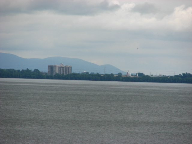
Mont St-Hilaire in sight. A cargo bypassing the Lachine Rapids can be guessed behind the tree line on the picture on the right of the building. This section were the cargo can be observed is part of the St-Lawrence seaway that allow cargo to reach the great lakes. Before the creation of the St-Lawrence seaway in the 1950s (the US Army Corp of Engineers were involved in its creation) every boat going upstream the St-Lawrence river could not go more upstream than Montreal because of the Lachine Rapids. The engineering behind the creation of St-lawrence seaway (the Lachines rapids is only one part of it) is apparently an incredible accomplishment I was told.


The Champlain bridge seen on the picture leads to downtown Montreal from the south shore.


Picture above: The point on the right is part of the above mentioned bird sanctuary. Try not to approach it even if you see people around. People can walk around the sanctuary but can not canoe around it !!!! There are also always people fishing on this point. The foggy line on the picture is due to the heavy white water (the roaring sound it makes is very impressive also). On a foggy morning that is the last place were the fog dissipates.


Picture above: Surreal effect due to geography and power of current. There are two currents observable here at 90 degree from one another. The current closer to the camera is perpendicular to the current seen the furthest from the camera which flows from right to left. 


Picture above: Here is a question to the geologists: how to explain that the rocks found in the Lachine rapids look alike rocks found around and on top of Mont-Royal in downtown Montreal ?