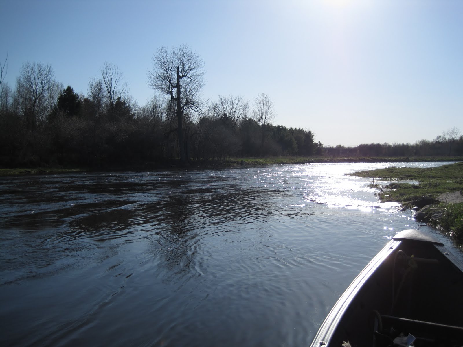
Lac des Deux Montagnes (Two Mountain Lake) is actually the end of the Ottawa river that bounce on the the northwest end of Montreal island. It appears as a big lake but that is just an illusion. It is home of monster Muske, Sturgeons and to the Lepisosteus Oculatus (a kind of Longnose fish that looks like a jurassic survivor). Two Mountain lake can look almost like an ocean when there is a 10-15 knot or above wind in a West or North West direction. It is a lot of fun to paddle in the waves that are generated during those days. I usually bring an anchor so I can rest on the lake and so that I do not loose the small distance I was able to make counter wind. To get access to Two Mountain lake from the Island of Montreal take the highway 40 toward the west part of Montreal island. Take chemin Ste-Mary exit. Go on chemin Ste-Mary. Turn right at the Couche-Tard convenience store if coming from the east than straight until the end of the road. Turn right, past the stop sign. You should soon see on your left the Anse à L'Orme municipal park. Parking fee is 7$ (credit card only). Here are some pictures when Two Mountain lake is peaceful. Following will be pictures when Two Mountain lake is mad (mad fun of course).


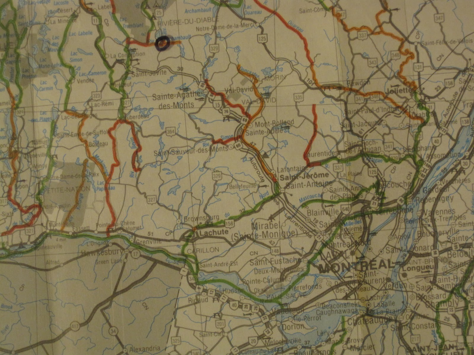
Above: Canoe landing spot is circled. Colored code map is from canoeing association Fédération Québécoise de Canot-Camping.


Here is the same place (in front of the the little island on the picture above) when there is a good west / northwest wind. Sorry for the lower resolution, these pictures are from a video I did while resting after putting my anchor in the lake.

I swear this is the same place.

The canoe I have (officially a Madriver Caption but I suspect it is actually an Outrage) have strapping gears that allow me to keep my balance in weaves and allow me to go counter wind since the straps gives a much better leverage when paddling. Surprisingly, I get sore legs after a paddling session like this and almost no soreness to my arms !!!!! The Madriver Outrage reacts very well in waves.

The rope of my anchor is visible on this picture. I suggest to someone that would want to use an anchor as I do to get a T shape paddle to allow you grab the anchor rope when you want to paddle again. I bring also a cheap surfing board I keep in the bottom of my canoe in case something wrong happens.
When there is no wind (rare) or a NE-ENE wind it is possible to cross straight from the bay of Anse à
L' Orme on the other side which correspond to Oka beach. There you will find a very nice beach around 5 km long. Crossing straight with a NE-ENE wind means that you will have the wind perpendicular to you both on your way there and on your way back. Covering your canoe with air ballon (as picture above) and / or by other means will help you being more aerodynamic. Near the Oka beach you will cross the boating waterway, so be careful. The waterway is typically made of two floating structure (usually one red and one green) that boats cross (every km I think). Boat people do make an effort normally to not get too close to canoes but sometimes they can only see you at the last minute, typically when you stand between the sun and the boat due to blurring effect of the sun on the water (from the boat perspective you could be invisible if you are in the blurring section on the water). The safest procedure I use is to assume the boat does not see me and then to adjust my pace and direction to either let the boat pass me in the front or to accelerate to make it pass behind me. Depending on your pace, you should be able to cross from Anse à L'Orme to Oka beach in an 1 hour or 2. Here are some pictures.


Above: Oka beach. Lots of birds. Beware poison ivy observed at some spots at the frontier between sand and green (poison ivy is typically only observed at the no vegetation frontier).

Above: Oka beach. Beach goes very far down the picture.

Above: Hydroplanes are common on the Oka beach side of Two-Mountain lake.