Since the water level this spring is just incredible in rivers in Quebec in general, we expected the tributaries of average size rivers could be canoable. The Diable river is an average size river for Quebec standards and its debit was around 50 m3/s on may 22nd according to an hydrological station. Its flows generally north to south near Mont-Tremblant ski resort in the Laurentides region. Laurentides region is all hills covered with mixed forests and plenty of lakes and rivers. Diable means Devil (Devil in french in Quebec is not a strong word; it is used in popular tales to make kids scared). Diable river ends in Rouge river that itself ends in the Ottawa river around 50 km upstream of Montreal island. Day 1 was to try to find a landing spot in either two of the Diable river tributaries which are the Le Boulé river or the Archambault river. We exited the 117 route at St-Faustin around 1:15 hr north of Montreal. Then took Lac Superieur direction. Around 10 km further turned right turn toward Lac Quenouille direction. Stopped at the bridge 2-3 km down where a resting Inn was on our right. We parked in the parking across the Inn which didn t seem to bother anyone. We landed our canoe at the end of the parking spot before the bridge. Our landing spot was at the end of Le Boulé river which ends in Archambault river. Went downstream into Archambault river and then upstream. There was too many rocky rapids to make it enjoyable when coming back downstream. Went back to Le Boulé river, then went upstream. Didn t go far until we encountered a nice drop in the river flow. The drop could be portaged on the right but we just wanted to chill out near that drop which was very nice. Here are some pictures.

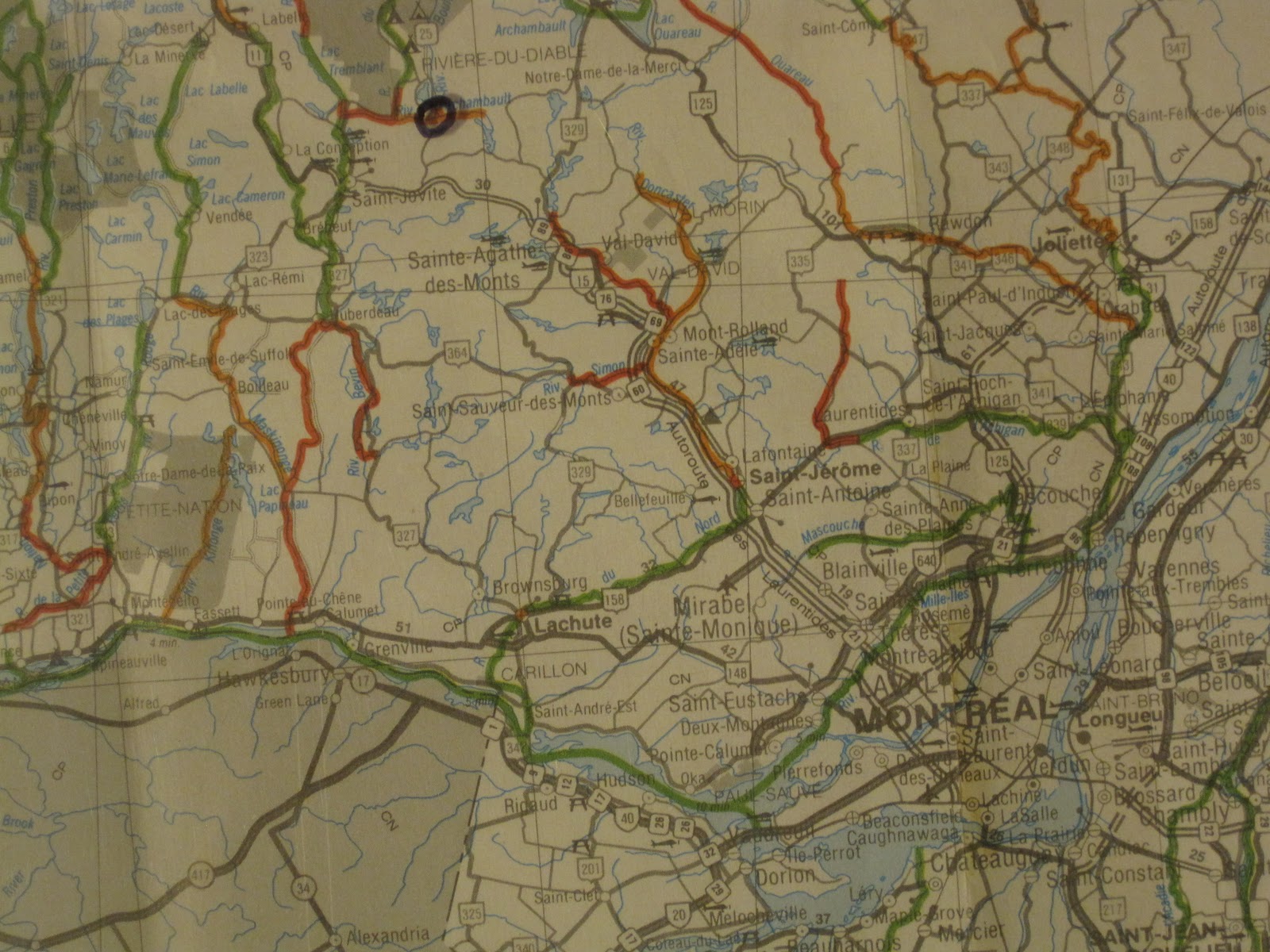
Above: Canoe landing spot is circled. Colored code map is from canoeing association Fédération Québécoise de Canot-Camping.
Le Boulé river is ultimately a 4th degree tributary of the Ottawa river. We stopped here before a drop and chilled out.

The river drop and a following basin. Portage on the right side in the woods appeared doable.

Trying to find a sweet spot for a little surfing. I am not an expert, it is still a trial and error process.

Trying to surf the white water coming out of the drop. A lot of water and air mixed together gives almost no leverage when paddling. Because of this I couln t go much more upstream.

There most be a big speckled trout hanging under this drop !!!!
Day 2 we wanted to canoe the Diable river. The resolution of our topological map is not high enough to be sure the rivers sections we want to paddle are flat enough to paddle upstream. So it is always a gamble when you decide of a spot for paddling upstream a river. After analyzing the map we expected the current of Diable river south of St-Jovite (renamed Mont-Tremblant) should allow us to canoe upstream. We identified two potential landing spot. First option was to use a tiny tributary coming out of Lac Maskinongé that end up in Diable river. From the 117 route we went south on the 327 toward Arundel village. Stopped our car around 5 km further south on the 327 were Lac Maskinongé tributary goes under the 327 road. Here are some pictures.

At first sight this little tributary of the Diable river seemed canoable down to the river but soon there was this (see picture below)

The tributary is actually a creek that looked canoeable from the road because of this tiny dam !!! Need plan B to getaccess to the Diable river.
Plan B was to go further south on the 327 road then first road to the right to the bridge on the Diable river that our topo. map predicted. Bridges are not always on option to have access to rivers. It all depends on the steepness of the river banks. This time the gamble paid off. See the pictures.


Above: canoe landing spot is circled. Colored code map is from canoeing association Fédération Québécoise de Canot-Camping.

Standstill tangled logs and trees were common on the river and allowed us to pause behind them during our upstream paddling. Need to paddle in zigzags to counter the current.

Another standstill tangle of logs and trees for a little rest. The current in general was deceptively strong since it looks so flat on the picture.

That spot was the further upstream we went. Time for beers.

Paddling downstream back to our car.
No comments:
Post a Comment